Category Archives: War

Santa Claus and Lapland’s Reindeer Antler Plan

I recently spent some time in Lapland for the Guardian. I wrote about my trip here  but thought I’d put a more complete version on the blog.

As soon as you land at Rovaniemi airport you see a reindeer. Not a real one admittedly, but somebody in a Rudolf suit cheerily greeting passengers who have just arrived and are planning to meet Santa Claus at his home in Northern Finland. A couple of miles from Rovaniemi airport –“Santa’s official airport” –  is Santa Claus Village, complete with elves, reindeers, huskies, shops, restaurants and the real Santa. It’s an attraction that draws more than 600,000 annual visitors to this isolated spot on the Arctic Circle.

There are reindeers everywhere in Rovianemi. Costumed at the airport, pulling sleighs at the Santa Village and recreated in statues throughout the town centre. There is also the outline of a reindeer embedded in the city’s streets. This is the “reindeer antler plan”, which was created by Finnish architect Alvar Aalto when he rebuilt the city after the Second World War. Aalto also designed the  town hall, library and concert hall, which are arranged in a complementary cluster to the south of the city centre. But while tourists flock to Santa Claus village, few seek out the work of Finland’s greatest architect. Frank Nieuvenhausen, a Dutchman living in Rovaniemi, hopes to change that through cultural tours that take in Rovaniemi’s museums, galleries and local history alongside the work of Alvar Aalto. “People get off the plane straight on a bus to the Santa Claus village but there is a rich history here,” he says. “We don’t all have to dress up as elves.”

visit-rovaniemi-map-reindeer-antler-town-plan-600x600

Rovaniemi was a quiet trading town of around 6,000 people before the Second World War. Russia invaded in 1939, and the Finns fought off their aggressors in the brutal Winter War of 1939-1940. After that, they allied with the Germans. The Finns were not Nazis and the Germans were not occupiers – this was a marriage of convenience to protect the Finns from the Russians and give Germany access to St Petersburg. Finnish Jews fought the Russians alongside German soldiers – three were offered the Iron Cross. Even today, this relationship continues. A few miles outside Rovaniemi by a lake is a memorial to the German war dead. It’s a peaceful spot, both respectful and isolated. The silence is only broken by the sound of Finnish jets protecting Rovaniemi from a feared Russian incursion.

Under the terms of German-Fin alliance, the country was split in half: the Finnish Army controlled the south and the German army had the north, with access to ports and nickel mines. The Germans were based in Rovaniemi and the town’s population doubled. The Luftwaffe built an airfield – Rovaniami airport – while Santa Claus Village itself is on the site of a German barracks. For years, the Germans and Finns got on famously. Then the war turned and the Russians told the Finns to expel the Germans or the Red Army would return. As the Germans departed, Rovaniemi was razed. Photographs show a smoking ruin with just chimney stacks left standing. Pekka Ojala, who runs a B&B and sauna near the city centre, still finds burnt wood and metal in his garden.

This desolation is what Alvar Aalto faced. But his ambition was vast. “He saw the burned town as an opportunity,” says Jussi Rautsi a former planner and researcher at the Aalto Foundation. Partly inspired by Franklin Roosevelt’s Tennessee Valley Authority Plan, Aalto created a plan for all of Lapland – a land mass as large as Holland and Belgium combined. The plan started with single housing units – designed to have as little cold north-facing façade surface as possible, and maximum external surface to the sun in south-west – and expanded outwards. Aalto factored in the hydroelectric plants being built on the great rivers of Lapland, and commissioned impact assessments to see what the effect would be on the environment, population, local industries, indigenous Sami, reindeer herds, water basins and microclimate. “Nobody in the world had done such a plan,” says Rautsi. “It had all spatial levels: regional, entire town, parts of towns, neighbourhoods, even peripheral estates. This was the only plan of this magnitude in the world.”

Rovaniemi’s “reindeer antler” street plan was conceived by Aalto in 1945. This was a stroke of visionary genius, as he simply imposed a reindeer outline on existing topography like those people who find animal shapes in the London Underground map. Aalto highlighted the natural shape of the land and the way the main roads and railway crossed. The football stadium became an eye, and the reindeer was born. It was magnificent branding, but Aalto then embellished the plan, creating different zones for commerce, residential and administration within the lines of the reindeer.

All this had to be built without Marshall Aid as the Finns had been on the side of the Germans and were also paying “reparations” to the Russians. Aid did come from the United Nations Relief and Rehabilitation Administration, the precursor to UNICEF, which was brought to Rovaniemi by the UNRRA patron Eleanor Roosevelt, the wife of FDR, in June 1950. Roosevelt wanted to visit the Arctic Circle, so the Finns built a log cabin near the airport, furnished with chairs designed by Alvar Aalto. They told her it was in the Arctic Circle although it was actually a little to the south. Roosevelt sent a letter from the cabin to President Truman – the first letter ever posted in the Arctic Circle – and wrote about it in her memoir. The log cabin became tourist attraction and was visited by other world leaders, including Brezhnev and Golda Meir. The log cabin still stands today on the edge of Santa Claus Village, where it is roundly ignored by tourists.

Tourism took time to build after the war but by 1984 Concorde was bringing visitors to Rovaniemi to see the Arctic Circle. That’s when some local entrepreneurs created the Santa Claus Village. According to Finnish myth, Santa came from Korvantunturi or Ear Fell, which is shaped like an ear so Santa can hear the wishes of every child in the world. Korvantunturi is to the far north and almost inaccessible, whereas Rovaniemi already had the airport thanks to the Luftwaffe. A rural-style wooden village was created around Roosevelt’s cabin, offering shops, reindeer rides, a Santa and a post office so visitors can send letters from the Arctic Circle. This is also where every letter addressed to Father Christmas ends up – up to 700,000 a year. In the 1990s, the Santa myth took over the town. Even part of one of the town’s nuclear bunkers was turned into Santa Park, a subterranean theme park.

As tourism grew, Rovaniemi was rebuilt. The zoning aspect of Aalto’s reindeer plan was never fully realised, but he did create three buildings for the town’s municipal centre. These were an undulating concert hall, a town hall (completed by his wife after Aalto’s death in 1976) and a library that is one of his finest works. He also built a small section of housing in the suburb of Korkalovaara, which featured terraced housing and two large apartment blocks that were modelled on the garden cities of England. In the city centre, he designed a Frank Lloyd Wright-style private home and a commercial block. Not everything Aalto planned came to pass but for Raulti his successes included “climate responsive housing, separating traffic from housing neighbourhoods, using local materials, the human scale and in situ brick construction. Sound building according to nature and terrain conditions. He wanted the community to have a good and visible centre and in Rovaniemi the Aalto-centre indicates its position as the capital of the polar region.”


These are the sort of buildings that Frank Nieuvenhausen wishes to show visitors as an alternative to the Santa experience. A knowledgeable and enthusiastic guide, he is creating an Aalto tour, and is being supported in this endeavour by Rovaniemi tourist office, who want to increase visitors in the summer months. “Summer used to be bigger, then cold and dark became exotic,” says Sanna Kärkkäinen, who runs Visit Rovaniemi. “We’d like to get that balance back.”

Santa is not the only challenge. As Aira Huovinen, curator of the Korundi contemporary art gallery acknowledges, the city’s cultural attractions also compete with nature – the Northern Lights, pine forests and wildlife. With most visitors coming for less than a week, that leaves little time to visit attractions such as the Korundi or the Arkitum, a local history/science museum. It doesn’t help that the city’s appearance is dominated by a certain post-war blockiness, encouraging tourists to stick to their out-of-town hotel resorts. There are some architectural highlights. The Arkitum has a stunning glass central corridor while the Korundi is located in one of the few buildings to survive the war, a huge brick bus depot that provided locals with shelter when the city was destroyed. Joining the gallery is a lovely new concert hall built for the Lapland Chamber Orchestra, while across the highway is a delightful and award-winning football stadium (the eye of the reindeer). The chief attraction is Aalto’s library, with its sunken reading pits, beautiful lighting and open plan. In one corner is a small section dedicated to Aalto, complete with Aalto-furniture and a picture of the reindeer antler plan on the wall.

You won’t see many tourists studying this however. It’s a different matter at Santa’s Village, which is open all year round but crammed in December. The experience isn’t quite as tacky as it might sound – we’re not talking Winter Wonderland levels of crassness – and children are enraptured. The Finns’ Santa has been shorn of any religious significance but isn’t excessively commercial. “We never let our Santa go to the mall,” says Mayor Lotvonen from his Aalto-designed office in the town hall. “He is a charitable figure.” Rovaniemi’s businesses contribute to a cheque for UNICEF at the start of every season, a reminder of the fact the city’s own resurrection and current good fortune came from an act of charity.

Santa occasionally accompanies the Mayor on official business to meet trade delegations, and he is an excellent and unique ambassador for the city. The international appeal of Santa can be seen by the make-up of Rovaniemi’s visitors, which is led by China, followed by Israel and then the UK. All find a Santa they are happy with. It’s tempting to see this as another example of the Fin’s seemingly infinite capacity for accommodation. They will make the German Army feel at home, move the Arctic Circle to keep Eleanor Roosevelt happy and then balance the needs of the West and East during the Cold War. So what would Alvar Aalto make of Rovaniemi’s adoption of Santa Claus? “Aalto liked people,” says Rautsi. “He was a social person. He would make Santa ride in a chaise lounge version of his Paimio chair pulled by three reindeers and they would leave Lapland with one of Aalto’s Savoy vases in their cabin luggage.”

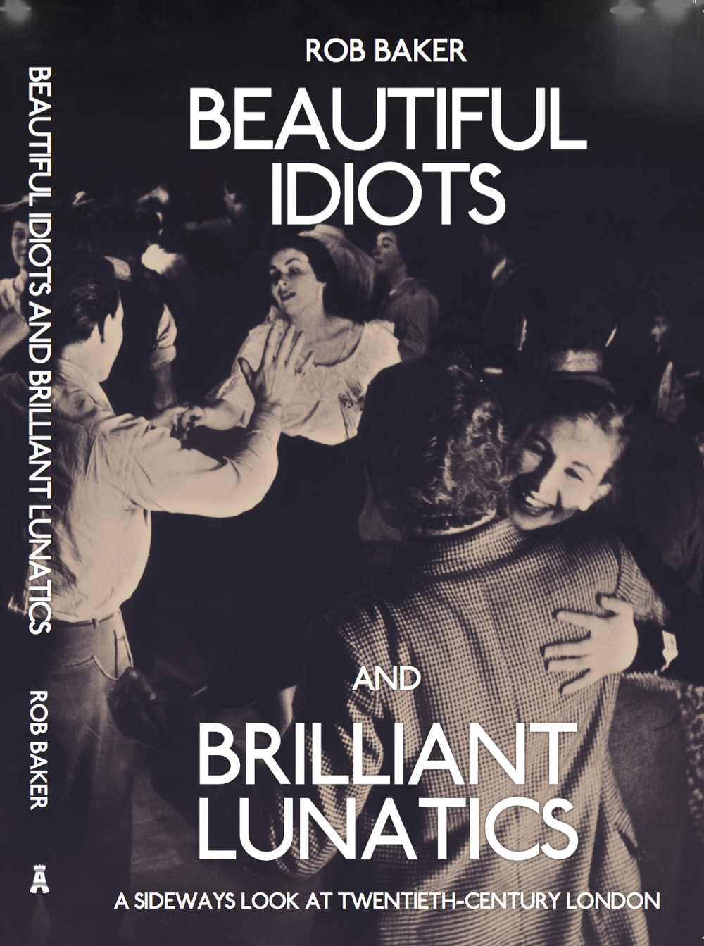


Beautiful Idiots and Brilliant Lunatics by Rob Baker

For several years, Rob Baker has written one of London’s best blogs, Another Nickel In The Machine, which explores the cultural history of London’s 20th century in a unique way. Rather than focus on, say, a musical genre or a particular locale or an identifiable concept such as celebrities or architecture, Baker simply finds great stories and researches the shit out of them. And now he’s turned it into an excellent book: Beautiful Idiots and Brilliant Lunatics.

As with his blog, Baker doesn’t pretend to find a unifying theme to artificially define the richness of his material, instead relying on his natural instincts to identify a good story and tell it for just the right amount of time. This is crucial. Some of these chapters cover some pretty big subjects – the Krays, Lord Haw-Haw, Christine Keeler, Pop Art – but Baker always manages to find a new angle without going on too long: for instance, his piece on Pop Art concentrates on Pauline Boty and the Anti-Ugly Movement while he looks at Blow-Up through a street in Stockwell that appears in the film. He’s brilliant at detail – clothes, weather, atmosphere, quotes – and tightly wound narrative (the section on the escape of spies Burgess and Maclean could come from a thriller), but he also loves exploring interesting tangents.

But his real skill is contextualising individuals within their era or locality. So his chapter on Benny Hill tells us much about the post-war comedy scene at the Windmill as well as Hill’s own rise and sad decline, the Profumo Scandal chapter is also about Soho and the Flamingo club in the early 1960s while the section of Winifred Atwell takes in Atwell’s strange career as a popular black performer but also the history of Brixton, where she lived.

This is essentially, the book of the blog, with several of the same stories, only expanded with new research. The blog also features great photography, just the right amount of which is reproduced here, including a cracking cover shot from the 100 Club, a venue that increases in importance with each year it avoids closure. Collectively, these photos and historical essays build a picture of London that captures some of the city’s chaotic sensibility far more truthfully than a conventional or even psychogeographical history, which will try and draw dry parallels between then and now, sometimes with lamentable results. Instead, Baker simply tells a story and then leaves you to think about what it means, if anything.

Some of these yarns I knew nothing about, such as the strange days James Earl Ray spent in Earl’s Court after assassinating Martin Luther King, or the spiv murder of Warren Street, or Charlie Chaplin’s wonderful return to Lambeth in 1921. Others I was familiar with, but still learnt more about, such as the plans to redevelop Covent Garden in the 1960s that was stopped by protesters – in the current climate, I wonder, would a similar protest have any success at all?  The net result is like being rattled round the London decades by a raconteur with a time machine, a sort of blue badge Doctor Who, who tells a story with wit and panache before whizzing you off to his next unpredictable destination.

The Blitz: missing buildings and false memories

While researching my recent feature on the Blitz and former bombsites in London, I was keen to find a site that had been destroyed and not yet redeveloped.

There were some tantalising leads.

Peter Larkham, professor of planning at Birmingham School of the Built Environment, provided me with an image he’d discovered years before of a derelict building on Lowndes Street, left fallow in memory of the Blitz.

Lowndes Street

“It was in the chartered surveyor professional magazine,” he explained. “The story was that it was owned by a family, bombed, and they never did anything to it in memory of a son that died in the war. Fifty years later, life had moved on, and the property came up for sale.”

It’s a compelling story but one that was difficult to confirm. The Bomb Damage Maps  showed a couple of strikes on Lowndes Street so I sent an email to Dave Walker, librarian at Kensington and Chelsea and writer of the formidable Library Time Machine blog. Dave put the query across to a colleague at Westminster, as Lowndes Street straddles the boundary between the two councils. Between the two of them, they discovered destroyed buildings at No 30 and Nos 11/12 Lowndes Street but both sites were developed by 1963. It would require further research to get to the bottom of the story as outlined by Professor Larkham and as tantalisingly revealed in the above photograph.

There was similar confusion with regard to another site. This was next to the Hat & Feathers pub on Clerkenwell Road.

Clarkenwell Road

Clarkenwell Road

According to local legend, the site had been demolished by a bomb and used as a car park ever since. For years, you could even see scraps of wallpaper from the destroyed building still attached to the neighbouring wall. The only problem was there was no record of a bomb landing anywhere near this property – itself rather extraordinary given how badly the area had been bombed. It appears that this was a false folk memory, but one that was still being shared today. In the end, I included no empty lots in my piece as I couldn’t find any that comfortably fitted the available facts.

After my piece was published, I was contacted by a photographer, Thom Atkinson. He was about to publish a book called Missing Buildings, looking at precisely this area – the missing spaces between London buildings ostensibly created by bombs. They’d even included an image of the Hat & Feathers site I’d been studying. Like me, Atkinson was intrigued with the way folk memory and evidence didn’t always correspond.

hatfeath

Photograph by Thom Atkinson

Thom said, “We came across the same sort of folklore thing a couple of times, and in a way that’s what the book is about. There’s a picture we made on Sclater Street, near Shoreditch Station, and the market traders there were talking about it being a bombsite when they were kids. When we looked at the map it didn’t quite fit their story – but they remembered it so clearly.”

There were several explanations for this, false memory being only one of them. As Thom explained, “Sometimes bombs are recorded and the site itself displays all the signs, but no building damage is shown on the LCC map. And of course the whole thing is complicated because the LCC maps only show damage during wartime – we’ve heard stories of buildings falling down or being demolished later on, because of underlying structural damage caused by the bombing – one of the guys who works in the processing lab (also a bombsite by the way!) has a house in East London with cracked foundations; the surveyor thinks they were caused by a bomb landing at the other end of the street.”

Missing Buildings is a wonderful book, showing the ghosts of London homes, many of which have long disappeared but still leave an imprint on neighbouring buildings in the form of shadows, new brickwork, girders and the spectres of chimney breasts. Others have been filled in with new buildings that stand out ridiculously against their neighbours, awkward and ugly, eternally temporary.

There are more of these spaces than you might imagine in London, but they are vanishing fast and this book is an exquisite record of the spaces that get left behind, often more by accident then design. You can buy it here.


The legacy of the Blitz

I wrote a piece for the Guardian about the way modern London is still shaped by the bomb damage of the Blitz. This was a subject I immersed myself for several weeks and the first draft of my article is very different to the version that was published. I thought it might be interesting to reproduce the original article on The Great Wen. 

————————–

When travel writer HV Morton surveyed London in 1951’s In Search of London, it was still scarred by war. The Blitz had started on 7 September 1940 and more than a decade later, London was a “city of jagged ruins, of hob grates perched in the sunlight in shattered walls, of cellars draped with willow-herb and Canadian fleabane.” As Morton wandered sadly round Cripplegate – an area now covered by the Barbican – he looked “across an area of devastation so final and complete that the memory of it will always rise in my mind whenever I hear the word Blitz. Thousands of buildings have been burnt and blasted to the cellars. Here and there the side of a building rises gauntly from the rubble, a detached gateway stands by itself in the undergrowth, the towers of a few churches, or a spire, lift themselves mournfully, like tombstones in a forgotten cemetery…. How can anyone reconstruct a town from its cellars?”

The scale of this destruction can be gleaned from the bombsight.org website, which uses information from the National Archives to pinpoint every individual bomb strike, and The Bomb Damage Maps 1939-1945, created by the London County Council and now published as a book, which show colour-coded bomb damage on a building-by-building basis. The maps were originally created for financial reasons, but post-war planning was always an issue. “The heart of it was insurance and compensation,” says Laurence Ward, the book’s editor and senior archivist at the London Metropolitan Archive. “But they had one eye on post-war reconstruction and the maps were essential tools for rebuilding London. They give a bird’s eye view of the damage and use a colour scheme that makes it easy to see areas that needed to be cleared.”

By cross-referencing Bomb Damage Maps with the A-Z and www.bombsight.org, London’s post-war evolution can be explored, with modern parks, offices and housing estates replacing black blocks of destruction. As Ward explains, “The maps help areas make sense, they show why the streets look like they do.” We look at six examples that show some of the ways the Blitz shaped contemporary London, and how that process is still continuing today.

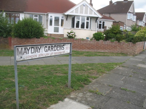
Mayday Gardens, SE3

Alan Lee Williams was 10 when his home in Mayday Gardens, near Blackheath, was hit by a parachute mine. “It was meant for the Thames, but damaged 27 houses and took our roof off,” he recalls, now 84 and reflecting on a life that included a period as Labour MP for Hornchurch. Williams’ house was repaired but several houses – marked black for “total destruction” on the bomb maps – remained derelict throughout the war. “They became places for children to play,” says Williams. “They built a big water tank on them for the fire engines, and sometimes we’d swim in it.”

Visit Mayday Gardens now and you’d have no idea anything had happened here. Unlike other streets, where former bomb sites can be identified by the post-war housing blocks that interrupt Victorian terraces, the destroyed houses in Mayday Gardens were rebuilt exactly as before. “They look as if they have been there all the time and I’m sure most people living there have no idea what happened,” says Williams. Indeed, when a local resident – who declined to be named – was asked if they knew of the street’s history, they admitted it came as news to them. “There was no consistency with the reconstruction,” says Ward. “These have pretty good plots and they probably decided it would be easier to rebuild a couple of houses then build a low-rise block.” One issue would have been the material available, with bricks remaining in short supply until the 1950s despite the LCC’s ability to salvage 140 million from damaged houses. The reconstruction of these middle-class homes, though, comes as stark contrast to the way many working-class districts were treated.

IMG_1342

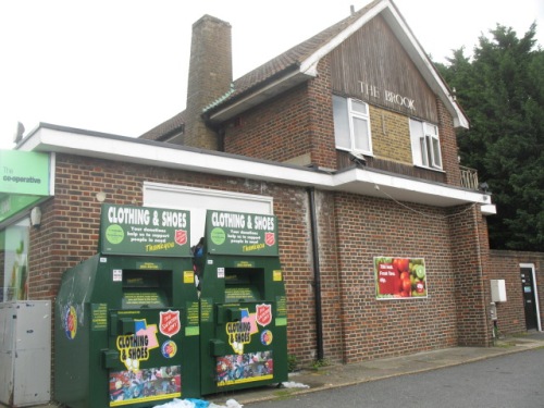
Co-Op, Brook House, Shooters Hill, SE18

A short walk from Mayday Gardens on the corner of Shooters Hill and Corelli Road is an ugly squat building housing a supermarket. This was the site of the Brook Hotel pub, which was hit by a V2 rocket in November 1944.

Alan Williams, then 14, was one of the first on the scene. “I was on a tram on Shooters Hill, when I heard an explosion and ran down the road just in time to see a No 89 bus explode,” he says. “The pub had been hit by the missile and the bus was passing and caught fire.”

Williams was pressed into service. “The fire officer called for silence so we could listen for people calling for help and we heard somebody,” he says. “The firemen were too big to go down, so they lowered me. I found a body still breathing and helped them pull it back up. We got to the top and the gas blew up beneath us – I never got out of a bombsite so quickly.”

He’d rescued a girl who had been playing with the publican’s daughter. “She lived in the same road as me, and her father was a high-ranking policeman,” says Williams. “He came to see us – my mother thought I’d been in trouble again!” In the carnage, 29 died but the pub was rebuilt immediately. “The pub was a lovely old building,” says Williams. “It was close to where soldiers were billeted so they rebuilt it before the end of the war.” Williams passes such bombsites frequently. “I still live in the area and I bow my head as I go past,” he says. “I can still see that 89 bus exploding. I always thought it was strange that there was never an explanation of what happened to these places. I thought they should have put up plaques. It’s always a puzzle why it didn’t happen, maybe they just wanted to forget.”

IMG_1340

Christ Church, Newgate

There are some memorials, if you know what to look for. Churches played an important role before and after the Blitz. Bombed churches were used as propaganda – a famous wartime photograph shows St Paul’s sheathed in smoke – and London’s churches took a pounding: 624 of 701 churches were damaged, of which 91 were destroyed. Many City churches were damaged by the fire bombs of 29 December 1940, which levelled entire streets.

Almost immediately, a debate began about what to be done with the most badly damaged churches. Architect Sir Edwin Lutyen argued in 1941 that “where there is no congregation I would leave the spaces occupied by destroyed churches as open”, partly as a memorial. In 1944, a letter in The Times presciently articulated this principle: “The time will come – much sooner than most of us to-day can visualize – when no trace of death from the air will be left in the streets of rebuilt London. At such a time the story of the Blitz may begin to seem unreal not only to visiting tourists but to a new generation of Londoners. It is the purpose of war memorials to remind posterity of the reality of the sacrifices upon which its apparent security has been built. These church ruins, we suggest, would do this with realism and gravity”.

The creation of these memorial-ruins was rooted in realism – with attendances in decline, churches simply weren’t always needed. The medieval church of Christ Church, Newgate had been rebuilt by Sir Christopher Wren in 1687 after the Great Fire and then razed again in the inferno of December 1940. It has been left in its ruined state in memory of the Blitz, but in bastardised form.

In 1981, neo-Georgian offices were added in imitation of the 1760 vestry – these currently house a dentist. Two walls to the east were removed in 1974 in a road-widening scheme, while the tower – with a steeple that Ian Nairn considered one of Wren’s finest – was transformed into a 12-storey private home in 2006. Merrill Lynch’s office squeezes against the wall of the church and the fact these gardens act as a memorial to the Blitz probably goes unnoticed by local workers – it’s all far too tidy for one thing. A short-lived campaign was launched in 2013 to turn this into a more thoughtful memorial to the sacrifice of Londoners, of which there are few. Christ Church at least fared better than another memorial-ruin: St Mary Aldermanbury was sold to Westminster College in Fulton, Missouri to act as a memorial to Winston Churchill. London still awaits a fitting tribute.

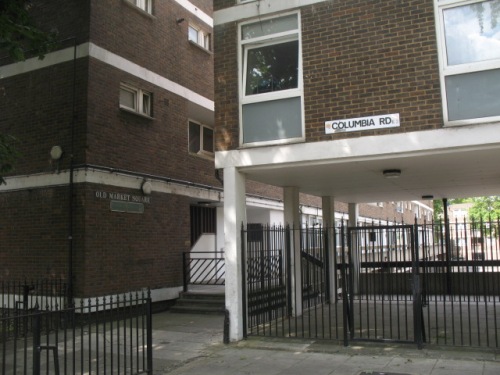
Old Market Square, Columbia Road, E2

A complex network of priorities faced London’s post-war rebuilders, many of whom had been agitating to reconstruct London since before the war. This bore curious fruit in Columbia Road in Bethnal Green, now the location of a flower market and genteel Victorian terraces but then considered a slum. On the first day of the Blitz, a bomb hit a shelter beneath Columbia Market, killing 38. “Columbia Market was a 19th century development founded by Angela Burdett-Coutts to regenerate the area and improve quality of life,” explains Ward.” The buildings were damaged during the war and subsequently demolished – but, it seems, they could have been repaired – the map notes that the main blocks suffered only general blast damage.”

Burdett-Coutts was a philanthropist and friend of Charles Dickens, and Columbia Market was a combination of market and social housing constructed in a dramatic neo-Gothic style that marked one of the first flowerings of Victorian social housing. The ambitious scheme was deemed a “splendid failure” by The Times in 1936 and after the war was being used for storage. Although salvageable and unquestionably important, it was demolished in 1960 and replaced by Ravenscourt Park and a modern tower block, named Old Market Square in a half-hearted nod to what was lost. This new estate is typical of the buildings that were thrown up after the war to solve the problem of slum housing. A campaign is ongoing to get a plaque erected in memory of those that died.

IMG_1352

In the haste to rebuild London, many important buildings were demolished, inadvertently spawning the modern heritage industry. “The idea of heritage and listing buildings only really started after the war, when things were demolished so rapidly we don’t know exactly what was demolished and what was valuable,” says Peter Larkham, professor of planning at Birmingham School of the Built Environment, who has written on post-war reconstruction. “It was launched as a problematic and ad hoc system that allowed councils to designate conservation areas. After development stopped with the 1970s oil crisis, conservation almost took over and we now have 10,000 conservation areas and half a million listed buildings. Some think we conserve too much.” The only remaining trace of Columbia Market is a section of railing outside a nursery. “It’s a fascinating building that most have cost a fortune and completely dominated the road,” says Ward. “Now you’d never know it existed.”

Palestra, Blackfriars Bridge Road, SE1

This 1990s office block sits atop a site with a fascinating jumbled history. In 1783, the Surrey Chapel was built amid fields by Georgian preacher Rowland Hill, who chose a circular – or octagonal – form as this meant there were no corners where the devil could hide. By 1910, it was being used as a warehouse when boxer Dick Burge decided to turn it into a boxing venue. The Ring was a success but was hit by a bomb on 25th October 1940 and then again in March 1941. According to the Bomb Damage Maps the spot was also later hit by a V1 flying bomb. Damage from one of these strikes can still be seen a few yards away under a railway bridge.

Like many bombsites, The Ring wasn’t replaced until the 1960s. “Some materials required for building were rationed until 1954,” says Larkham. “Every bomb-damaged city was arguing with the government for their allocation of steel and you might have a site and a plan but you might not be able to do anything with it. Britain was selling steel to Australia because the economy was more important than rebuilding.” Eventually Richard Seifert’s gaunt Orbit House was raised on the site. Seifert, one of the UK’s most prolific post-war architects, loved to give his buildings space-age names, and this one also had a circular nod to The Ring. It housed records for the India Office.

But Orbit House’s time was fleeting. In the 1990s it was replaced by Will Alsop’s gargantuan glass Palestra, which is used by TfL. Peter Rees, the City’s former head of planning, once told me that modern office buildings have a life of around 30 years – something that has more to do with the changing requirements of office life than architectural trends – and that’s how long Orbit House lasted. But with his new building, Alsop paid reference to both of Palestra’s forefathers: like Orbit House, it is raised above the road on a pedestal, while its name comes from the Greek word for a wrestling ring. What’s interesting, though, is that as with much of London’s post-war offices – include huge swathes of the City – this site is already on its second generation of development. Larkham questions if that is sustainable. “One of the worst products in terms of sustainability is concrete,” he says. “The fact we can put these building up and then pull them back – is that really the best solution? We need to design for more flexible longer-term planning.”

Elephant Park, SE17

You won’t find Sayer Street on a map but you can hunt it down in photographs. One on the IWM website shows a family sitting at a dinner table outside the Blitzed shell of Sayer Street School eating egg and bacon supplied by American aid.

Another shows Sayer Street before the Blitz, when it consisted of five-storey tenements in one of London’s poorest areas around Elephant & Castle. Elephant was badly hit by bombs, and Sayer Street is riddled with damage on the Bomb Damage Maps. Before the war, the street contained a fishmongers, cat meat dealer, grocer, saddler, bookbinder; after the war, it was the location of a car park, one of the most popular post-war uses for bombsites. The NPC car park empire began with the purchase of a £200 bomb site on Red Lion Square.

In his memoir The Likes Of Us, Michael Collins writes how in the 1960s he explored Elephant’s remaining bombsites, “on which relics of former homes hovered, exposed broken fireplaces and floral or barley corn wallpaper that had witness births, deaths, Christmases, parties, tears, arguments, laughter and sex.” Sayer Street survived this half-life into the 1960s, when it was chewed up by the Heygate Estate. The Heygate was originally conceived as one of three gigantic housing estates that would stretch from Elephant to Peckham, linked by walkways and ramps for two miles. “It was said the planners decided which streets would be erased in the back of a taxi as they were driven around the neighbourhood,” writes Collins, who was forced from his childhood home. One of those to disappear was Sayer Street.

As Larkham explains, “some of the plans were incredibly radical, sweeping away neighbourhoods irrespective of damage and replacing them with high-rise towers nobody wanted to live in.” These were fuelled by idealism, but as early as 1945, the planner CB Purdom had warned of the dangers in How Shall We Rebuild London?, explicitly rejecting Le Corbusier and “the megalomaniac proposals of those who regard the metropolis as a hive of near termites speeding their existence upon escalators or in tubes.” Such pleas were ignored and towers went up on bomb sites all over London. Some were successful like the Barbican, but most were bleak, poorly built and badly maintained.

The Heygate was rarely popular but it housed many of London’s poorest and now it too is gone, having lasted 37 meagre years. Southwark sold it to Land Lease, a private developer and demolition began in 2011. Former residents have been shipped miles from London, displaced even more brutally than those who once lived on Sayer Street. In its place will come Elephant Park, a residential village of towers and plazas, where a three-bed apartment costs £2.5m. “It says a lot about where London is heading, how it is become more like Paris with those areas of social housing being pushed further out,” says Ward. The ripples from London’s post-war redevelopment continue to be felt, and from Blitzed streets and lost bombsites, another London arises. How long will this one last?

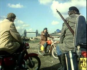
Survivors in Wapping, 1976

Survivors was a TV series made by the BBC in the mid-1970s that explored Britain’s post-apocalyptic near future. With most of the world’s population killed by plague, the survivors were ‘reduced to trudging across the countryside in their parkas’ (Dominic Sandbrook in Seasons In The Sun) in search of food and shelter. The creator, Terry Nation, went on to make Blake’s 7. The series featured numerous guest stars – Brian Blessed, Patrick Troughton – as well as faces that would become better known in the 1980s like Dot from Eastenders, Peter Duncan from Blue Peter and Trigger from Only Fool’s And Horses.

It’s Trigger, aka Roger Lloyd-Pack, who you may recognise in the pictures below. They come from an episode shot on  a bleak wasteland in Wapping in 1976.

In the absence of an actual post-apocalyptic landscape on which to film, the decimated docks of Wapping made a handy substitute. The main location is the site of the current Hermitage Riverside Memorial Gardens – then a bombsite but now the location for London’s only memorial to the civilian dead of the Blitz – but there are several interesting looking buildings in the background. Reader Steve, who sent me the pictures, wants to know if any of these buildings remain. (Other than Tower Bridge, obviously.)

If you know, please tell us in the comments below.

steves032

steves033

steves034

steves035

steves036

steves037

steves038

First World War in London

Britain declared war on Germany 100 years ago today on 4th August, 1914, and to mark the centenary of the outbreak of the First World War I was asked to write a piece for Metropolitan magazine looking at some of the most remarkable items from the refurbished Imperial War Museum.

pigEdith

The selection includes items as varied as a mounted German pig’s head and Edith Cavell’s nurse cap. One thing I like about the IWM is that it is very good at driving home individual stories amid the context of immense global suffering and complex geopolitics, meaning you can find numerous, remarkably touching, small personal items in its collections, such as this postcard written on a piece of wood from the Western Front.

Picture 4172

One of the favourite items I came across – or rather, which the incredibly helpful press team at the museum pointed me towards – was this decorated tin, painted by a disabled Belgian soldier in London as part of a fascinating occupational therapy programme.

belgiantin

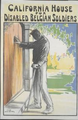
The fascinating story of California House at 82 Lancaster Gate is recounted here, but in short the hospital was set up in 1914 by an American expat artist and writer called Julie Heyneman, who – like many in London in the early months of the war – was horrified by the casualties caused by the German advance into Belgium. California House became a refuge for injured, displaced Belgian soldiers who were taught languages and sciences.

CH

Those left paralysed or limbless were encouraged to take up activities like painting, book-binding, wood-carving and drawing – anything that required manual dexterity. Objects created, such as the tin above, were then sold to Londoners, with the soldier-creator keeping some of the proceeds. A similar establishment, Kitchener House at Cambridge Gate, Regent’s Park, was set up for British soldiers. California treated around 500 soldiers, some of whom were able to return home after the war and make a living from their new skills. It closed in 1918.

california

Wappingness

This is an edited version of a piece about Wapping  written in 2011.

‘Explore Wapping,’ exhorted Samuel Johnson to Boswell, ‘to see the wonderful extent and variety of London.’ It is fine advice still. Johnson was speaking in the 1790s, when Wapping was London’s principle settlement for sailors, a hive of cobbled streets and damp, narrow alleys that led to the numerous wharves and jetties of riverside London, but his instruction rings true today. Explore Wapping and see how London can demonstrate a seemingly infinite capacity to reinvent itself, how it will welcome newcomers and how it celebrates its past while never neglecting to engage with the future. Few cities have such a knack at looking simultaneously backwards as well as forwards, and few places in London do this better then Wapping. Here, Morrissey explores Wapping landmarks in his 1992 video, “We Hate It When Our Friends Become Successful”, just as the area was undergoing heavy gentrification.

To understand Wapping try approaching it from St Katherine’s Dock, the pretty riverside development that lies adjacent to the Tower of London. Leave St Katharine Dock at the point where it almost touches the Thames and you will arrive in Wapping at the very western end of Wapping High Street, the charismatic street that runs parallel to the river for the length of the district. Here, on the corner with Kennet Street, is a large stone wall, decorated with icicle-like drips of cement. Inside the wall is a large red brick building, which still proudly wears the emblem of the Port Of London Authority, although this has over time turned the sort of misty green colour you associate with cannons dredged from the ocean floor.

This is the old dock house, a remnant of when Wapping was home to London Docks, and it stands next to Hermitage Basin, one of the few parts of the dock complex not to have been filled with concrete and covered with roads and houses in the 1970s. Hermitage Basin once offered a way for ships from around the world to get from the mammoth London Dock to the Thames, but now it is a sweet little ornamental lake surrounded by houses, and a home itself to a sedate family of regal swans and the odd mallard.

Hermitage Basin is a fine example of what you could call Wappingness: the way Wapping has come to terms with its past, making sensible accommodation with what has been before. This has not been an easy task. Wapping has been battered by change over the centuries, first when the docks were built in 1805, carving great watery holes throughout the neighbourhood and reducing the population of 6,000 by two thirds, and then when they were filled in again in the 1970s, eradicating what had been Wapping’s identity for more than 150 years. The warehouses and docks of Wapping were also heavily targeted by German bombers during the Second World War. But still it prospers.

Signs of Wapping’s maritime heritage are everywhere. Before the docks arrived, it was a place of wharves, jetties, warehouses, boatbuilders, sailmakers, brothels and pubs, having been originally settled by the Saxons and used by London’s sailors for centuries. The building of the docks over reclaimed marshland helped cement these long links with the sea, even if they replaced the bustling village atmosphere with vast warehouses and a more transient population. The London Docks were the closest docks to the City of London, which gave them a significant advantage over those docks that had recently been built on the Isle of Dogs.

In these Wapping warehouses, dockers would unload treasures from right across the British Empire, including tobacco, rum, whalebone, spices, cocoa, coffee, rubber, coconuts, marble and wool. Settlers from overseas lived in Wapping – nearby Limehouse was home to London’s first Chinatown and is now home to a thriving Bangladeshi community – and artists, writers and poets would come to Wapping to glimpse exotica in the form of both the goods brought from overseas and in the working-class men and women who lived and worked in the area. They would then disperse around London and the East End, taking some of the essence of Wapping with them across the Highway into Whitechapel, Spitalfields and beyond. Later still, artists set up studios in the derelict warehouses of Wapping in the 1970s, heralding a trend that soon spread throughout east London.

The chief attraction, of course, was the river, although the Thames itself can only intermittently be glimpsed between the tall warehouses that act almost like a river wall. But stroll round Wapping and you’ll see signs of its maritime history everywhere in the shape of weathered dock walls, converted warehouses and industrial walkways that allow passageway high above the cobbled streets. Here are restaurants and pubs that pay homage to the past, plus a pretty canal that stretches in a narrow strip from Hermitage Basin in the west to Shadwell Basin in the east, offering a slender shadow of the bustling docks that once stood here. Between buildings on Wapping High Street you can see numerous ancient stone stairs, green with age, that lead directly down to the river.

Such is the all-pervasive water-soaked atmosphere that Wapping itself can even feel like something of an island, bordered on three side by the liquid barriers of the Thames, St Katherine’s Dock and Shadwell Basin and with a busy main road, the Highway, to the north, cutting it off from the rest of London. And within this island, there is just as much to explore as there was in Johnson’s time. You can find London’s oldest riverside inn, the grisly site of pirate executions, an abandoned shopping centre, a gorgeous listed church, a power station turned art gallery, a historic foot tunnel, London’s only memorial to the Blitz, a beach that the Beatles posed on, mudlarks searching for Tudor bric-a-brac, Wapping Wood and an escaped tiger. So follow Johnson, explore Wapping, embrace Wappingness.

Secret London: torture at the Temple

In some parts of London you can travel in space as well as time. Take the Temple. This characterful cluster of medieval buildings, gardens, courts and alleys wedged between Fleet Street and the Thames seems to have been uprooted from an Oxbridge college and dropped brick-for-brick in central London, just a heartbeat from the Embankment.

The Temple is a maze of cobbled paths and narrow arched doorways leading to small courtyards that have names like Pump Court and King’s Bench Walk. Most of the buildings are offices occupied by lawyers – this is London’s legal quarter, where barristers receive their training – but the area is also popular with tourists, who have found their way into this most secluded spot. They are here to see the Temple Church, one of London’s oldest churches and, with its distinctive circular nave, also one of the most atmospheric. It’s a building that exudes medieval mystery, and rightly so. Temple Church was founded by one of the world’s most intriguing secret societies, and continues to exude a curious, almost sinister vibe, a feeling that there is more to the Temple than meets the eye.

Even those who know the place well can sense the mood. ‘Buildings have memories,’ says Oliver the verger. ‘And this building has seen some turbulent times.’ Oliver is an intense young man who holds the keys to the secret parts of Temple Church. But that must wait. First, he offers a potted history, one that explains why the Temple is off the beaten track but very much on the tourist trail.

The great London writer HV Morton wrote in 1951 that ‘The Temple brings into the heart of a great city the peace of some ancient university town and the dignity of a past age’, and although the Temple area is redolent of Oxbridge its holy centrepiece is actually a stand-in for a more distant city. The Temple Church was built by the Knights Templars in the twelfth century. The Templars were a holy order formed in 1118 to protect European pilgrims visiting the Holy Land. Their base in Jerusalem was supposed to be the site of the Temple of Solomon, so the warrior-monks became known as the Knights Of The Temple of Solomon of Jerusalem, soon shortened to Knights Templars. The Knights Templars had churches and land all over Europe. In London they settled in Holborn but moved nearer the river in 1162, where they built the church. This great round edifice, the New Temple, was consecrated in 1185. Its circular nave paid direct homage to the Church of the Holy Sepulchre in Jerusalem, the idea being that Londoners could visit Jerusalem without leaving the city. Such symbolism was easily grasped by medieval worshippers, who understood how one place could represent another and how the present could fold into the past.

The Knights Templars’ management of the routes in and out of the Middle East soon brought them great wealth, with which came great power, with which came great enemies. Rumours – started by rivals in other religious orders and the nobility – began to spread of their nefarious conduct, and of their sacrilegious and obscene initiation ceremonies, which took place on sacred ground, in London’s case in the crypt beneath the church. It was said that members spat on the cross, worshipped cats and practised ‘unnatural vice’ with each together. As hostility heightened, the end was inevitable and bloody. Phillip IV of France, who, coincidentally no doubt, was heavily in debt to the order, arrested leading French Templars in 1307 and through torture and imprisonment, gained lurid confessions about their immoral conduct. The order was dissolved in 1312.

Although the end for English Templars was not quite so brutal, the abrupt dissolution of the order – and the rumours that surrounded it – has provided fertile ground for conspiracy theorists. Some argue that the Templars were abolished because they knew more about the origins of the organised church than they should, others claimed that the Templars did not disappear, but were merely pushed underground and continue to operate to this day as a clandestine force that shape the world order. Novelist Dan Brown seized on versions of these myths for his blockbuster ‘The Da Vinci Code’, and, having done his research, settled on Temple Church as a suitably spooky location for some key aspects of the action.

52 TEMP 14.jpg

Brown was doubtless drawn by the dominant feature of the church, the ten statues of knights that lie on their backs on the floor in the centre of the circular nave. These stone effigies of dead Templars are frozen in time like Neolithic humans dredged from a peat bog. Despite having lain here since the twelfth century (one, commemorating Geoffrey De Mandeville, is dated 1144 making it older than the church itself; it is said to be here, because no other church would bury him), some have sharp, fine feature, while others have faces melted by German incendiary bombs. All look like they are covering something, perhaps an opening to a secret chamber. They certainly appear to serve some function greater than mere decoration. When you stand in the airless centre of this strange church, looking at this ancient stonework, you can feel the clammy arm of history encircling you. For centuries, Londoners and travellers will have stood at this spot, and bar some cosmetic changes – the church has been refurbished three times, by Christopher Wren, by the ever-busy Victorians and after the Second World War – will have gazed upon the same sight. Nothing has changed.

Oliver the verger interrupts my reverie with some subtle key jangling. We head over to a small door, which he unlocks to reveal a spiral stone staircase. We are seeking the penitential cell. This is where the Master of the Temple – the gloriously authoritarian title given to the church’s head priest – used to punish the unholy. The unfortunate Walter Bachelor was left to starve to death in the penitential cell after disobeying the Master, which is a particularly serious form of penance  as you can’t really repent after you are dead. The cell is halfway up the stairs and now has the appearance of a broom cupboard. It’s tall, but narrow, so a man can stand but not lie flat. Most disturbingly, it has windows overlooking the interior of the church, so those sentenced to starve could look down upon the statues of the crusaders, who would bear silent witness to the suffering taking place above. When we talk of a punishment being medieval, this is what we mean.

Oliver does not enjoy talking about the penitential cell, understandably uncomfortable with such ugly things occurring in the place he has to work every day. He also maintains a theological distance. He says this cruel punishment must have been a Templar thing, nothing to do with the organised church of the time. The Templars, it seems, are destined to play the role of scapegoats for centuries to come.

Oliver and the current Master, though, are happy to play the Templar connection to their advantage when it suits. Dan Brown’s novel brought unprecedented interest in their church, and the Temple suddenly became a hit on the tourist circuit. The Master wrote a book debunking the myths and generally tapped into the new-found interest. Now ‘The Da Vinci Code’ fever has worn off, but the Church has stayed in travel guides on its own merits, remaining a must-see for tourists from all over the world. Here they learn about the Temple Church’s history after the order was dissolved. After passing into the hands of the crown, the surrounding Templar land was given to barristers in 1608. They had begun to locate here from around the fifteenth century. After receiving the land rent-free, the barristers agreed to maintain the church and the Master in perpetuity. The most colourful example of them protecting the church occurred in 1678 during an outbreak of fire. The junior barristers quelled the flames with beer; it took six years for them to settle the brewer’s bill.

In preparation for the arrival of the day’s first tourists – and some are already milling outside waiting for their chance to snoop the ancient masonry – Oliver throws open the vast West Door. This huge arched door opens on to an easily overlooked alleyway, on the opposite side of the church to the large square that fronts the main entrance. It is a magnificent piece, thick regal wood surrounded by an arch of elaborate carved stonework. Nobody knows its age, although Oliver points out that some of the faded figures are wearing buttons, which were supposedly unheard of in Britain before the fourteenth century as they were associated with Muslims, the very foe the Templars were formed to fight.

Standing in this quiet spot round the back of the aged church staring at a door that by implication if not construction dates back to the twelfth century, it is easy to feel that you have slipped through time. One London writer, James Bone, said in 1919 that ‘At Temple, you are as close as an echo to the past’. Here, the echo resounds loudest and longest.

Nazi Olympics at the Wiener Library

This article first appeared in a recent issue of Time Out London.

The 1936 Berlin Olympics are often presented as a disaster for Nazism thanks to Jesse Owens, who won four golds and shattered Hitler’s fantasies about Aryan superiority. But the truth is a little more complex. Germany actually won the games: they had the most medals and also won more golds, more silvers and more bronzes than anybody else. They were praised for the way the tournament was held, there were no boycotts, innovations like the Olympic village and the torch relay were adopted by the Olympic organisation and the event even turned a profit. So was it really an unqualified sporting, diplomatic, economic and propaganda success for Hitler?

Toby Simpson is curator of The Nazi Games: Politics, The Media And The Body, an exhibition at the Wiener Library, London’s Holocaust library (the oldest in the world). He says, ‘The games were actually received very positively and Hitler’s standing improved as a result. On the whole it was positive for the Nazis and they were pleased with the results.’

This was much as Hitler had hoped when the Nazis inherited the games in 1933. ‘The German organisers were worried he would scrap the games because he wasn’t internationalist in the slightest,’ says Simpson. ‘But he realised that this was a huge propaganda opportunity and began putting pressure on the organisers to shape the games around Nazi interests.’

The results are displayed in a small, compelling exhibition. There are dramatic stills by Leni Riefenstahl, who also filmed the monumental Olympia using new techniques such as slow-motion and tracking shots. Much of the imagery presented the German team as perfect Aryan specimens, evoking Spartan concepts of athleticism, while a neo-Roman bombast was visible in everything from the architecture to the opening ceremony. Hitler wanted to exclude Jews from the team, but under pressure allowed one, Helene Mayer, to take part. ‘Mayer won gold in fencing for Germany in 1928,’ says Simpson. ‘Under Hitler, she had to go to the US to continue her career, but came back to Berlin to compete in the German team.’ A photograph shows Mayer on the podium giving a Nazi salute. All successful athletes were presented with an oak sapling – until 2007, one won by Harold Whitlock, a long-distance walker, grew in the grounds of a school in Hendon.

US team – including Owens with their oak saplings

Mayer’s presence was a sop to a small but persistent anti-Nazi campaign. ‘This was the first Olympics with a boycott movement,’ says Simpson. ‘America was criticised for participating because it was believed they could influence the International Olympics Committee to withdraw the games from Berlin.’

The exhibition features an American pamphlet called Preserve the Olympic Ideal, which made the case against American participation. There’s also an extraordinary camouflaged pamphlet produced by resistance movements in Germany. It looks like an Olympic souvenir but ‘inside talks about soldiers bleeding to death on the fields of Spain. Germany was not yet involved in the Spanish Civil War, but this was being distributed to inform people about what was going on.’

The exhibition has a range of bona fide souvenirs produced to cash in on the games, often incorporating Nazi imagery, and there’s also material produced by travel agents like Thomas Cook, hoping to persuade reluctant tourists to make the journey. ‘Ticket sales were slow at first,’ says Simpson. ‘The Nazis had come to power on a wave of mass unemployment and people worried the country was unstable. Companies offered huge reductions in an unprecedented advertising campaign.’

BERLIN OLYMPICS 1936 (GERMAN ORIGINAL PHOTO BOOK)

The public had fewer concerns politically. ‘The Nuremberg Laws had turned Jews into second-class citizens, but public consciousness was slow to catch up with reality,’ says Simpson. During the games, the Nazis removed anti-Semitic signs in a ‘conscious attempt to cover up the truth.’ At the same time they put 800 Sinti and Roma into camps. The Wiener Library has a game on permanent display in which stereotypically Jewish-looking characters are chased around a board – it was made in 1936. ‘Even as the Olympics were taking place, this game was being produced and people were being put in concentration camps because of their race,’ says Simpson.


The exhibition ends on a positive note. ‘We highlight the story of Dr Guttman, a German-Jewish refugee who came to Britain in 1939 and set up a spinal unit at Stoke Mandeville hospital for veterans. There he introduced a sporting contest that eventually became the Paralympics.’ Some of Guttman’s documents are on display, including call-up papers from the First World War. ‘He volunteered in 1914 to serve in a medical capacity. Like many Jewish Germans he was incredibly patriotic but still exiled.’ It was an exile from which the Olympic movement would eventually profit.

The Nazi Games: Politics, The Media And The Body at the Wiener Library until October 3. Free. 

Turing at the Science Museum

There’s a rather fine exhibition at the Science Museum at the moment about Alan Turing, the pioneering computer scientist and philosopher who was born 100 years ago. What particularly appeals is that while there is only a limited number of objects, all of them matter.

This is hefty stuff, invaluable weighty objects that demand attention – so it’s blockbuster, but not in the usual way of throwing everything at a room in an attempt to wow the audience into submission at the sheer scale of things. Instead, the museum has cherry picked a dozen important objects that most reflect Turing’s life – the life of one of the most important figures of the 20th century – and let them tell the story. As the curator David Rooney told me, ‘A lot of what Turing did was very abstract. We wanted to show it had a real impact on the world.’

Featured items include an Enigma machine on loan from the secret staff-only museum at GCHQ, the Pilot ACE (one of the world’s first computers), a cybernetic tortoise, a 1930s differential machine made out of Meccano, Turing’s pathology report (which shows he drank a large amount of cyanide, more than you could consume by accident or put in an apple) and a section of a crashed Comet jet, which the Pilot ACE was used to analyse to see why it exploded in mid-air.

Enigma machine

Crashed Comet G-ALYP, 1954.

Pilot ACE

Meccano differential analyser

Here’s a film of the tortoise in action.